VELMA Ecohydrological Modeling
Visualizing Ecosystem Land Management Assessments (VELMA) was developed by the EPA is a “spatially distributed, ecohydrological model that links a land surface hydrology model with a terrestrial biogeochemistry model for simulating the integrated responses of vegetation, soil, and water resources to interacting stressors” (https://www.epa.gov/water-research/visualizing-ecosystem-land-management-assessments-velma-model-20). Inputs to the model to model current conditions include elevation (represented by a digital elevation model), land cover, land cover age, biomass, initial land cover biomass, pervious surface, soils, temperature, and precipitation (Figure 1).
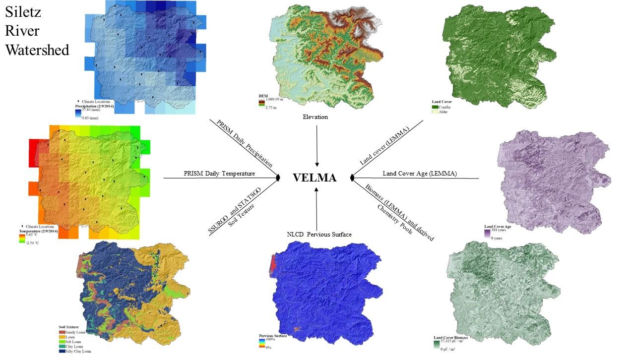
Figure 1. Spatial data input to VELMA Siletz River watershed
By integrating these data sources, VELMA produces daily flow estimates as well as other metrics including, but not limited to soil saturation, nutrient pools, biomass (Figure 2).
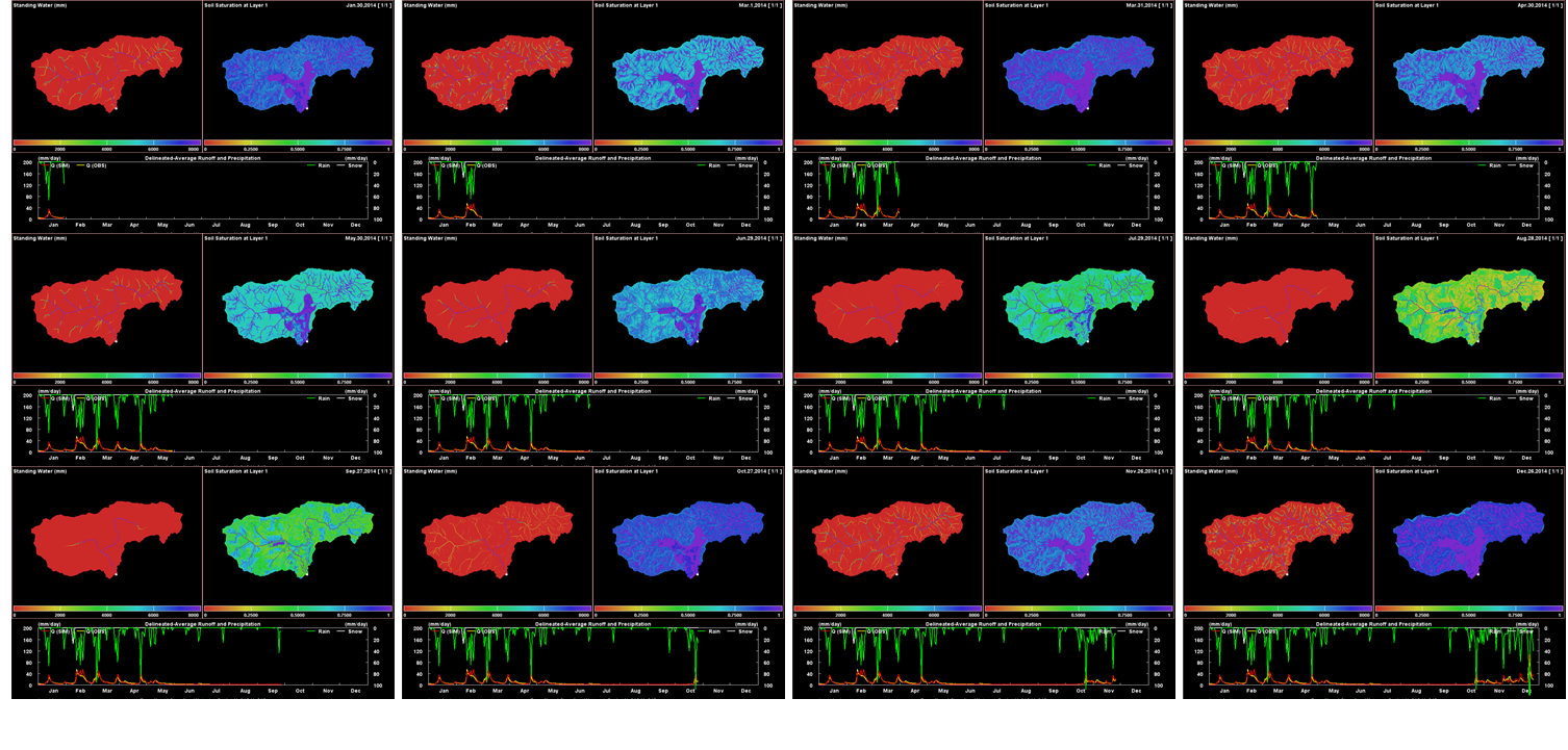
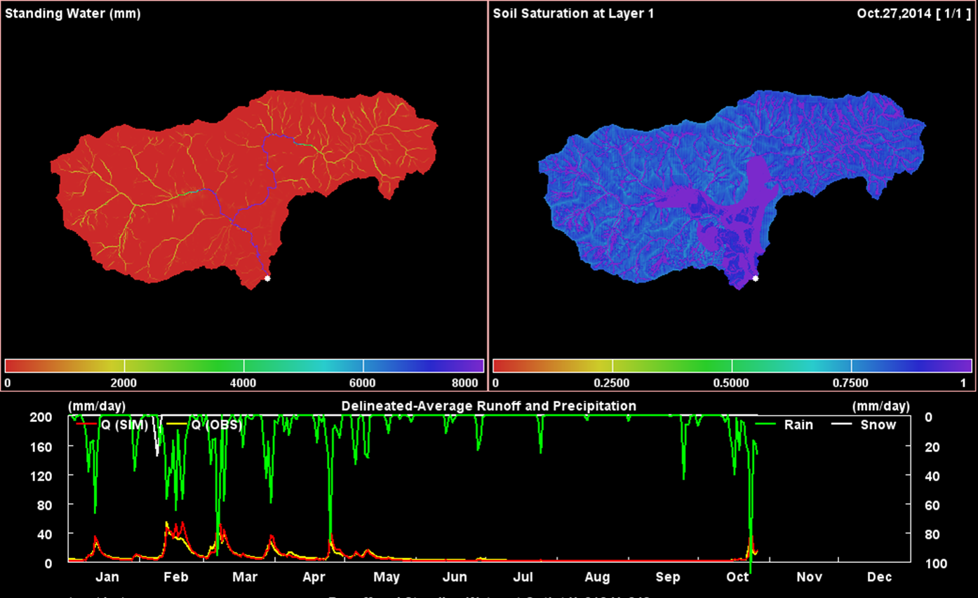
Figure 2. Example of VELMA Output in a portion of the Siletz River watershed
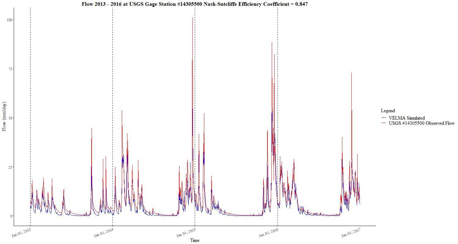
Figure 3. A comparison of simulated and observed data at USGS Gage Station #14305500.
In other watersheds, our VELMA has produced NSE values from 0.71 to 0.89. The first wave of VELMA modeling will cover the watersheds occupied by the 21 functionally independent coast Coho Salmon as defined by the Oregon Coast Coho Conservation Plan (https://www.dfw.state.or.us/fish/crp/docs/coastal_coho/final/Coho_Plan.pdf; Figure 4)
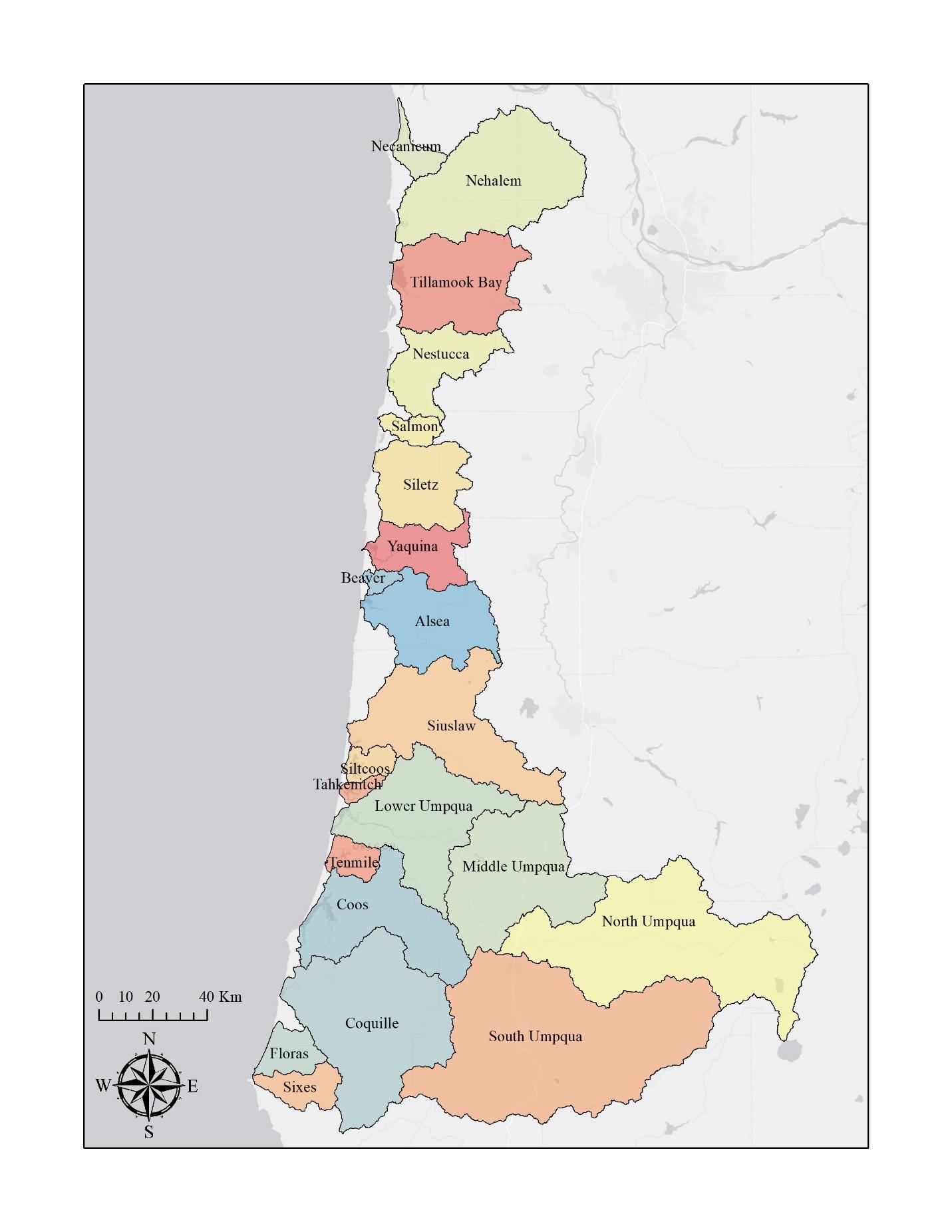
Figure 4. 21 Independent Coast Coho populations as defined by the Oregon Coast Coho Conservation Plan
All data to run VELMA has been collected and formatted for all 21 watersheds, and current conditions modeling is ongoing. As current models are completed, the map below will be updated (Figure 5).
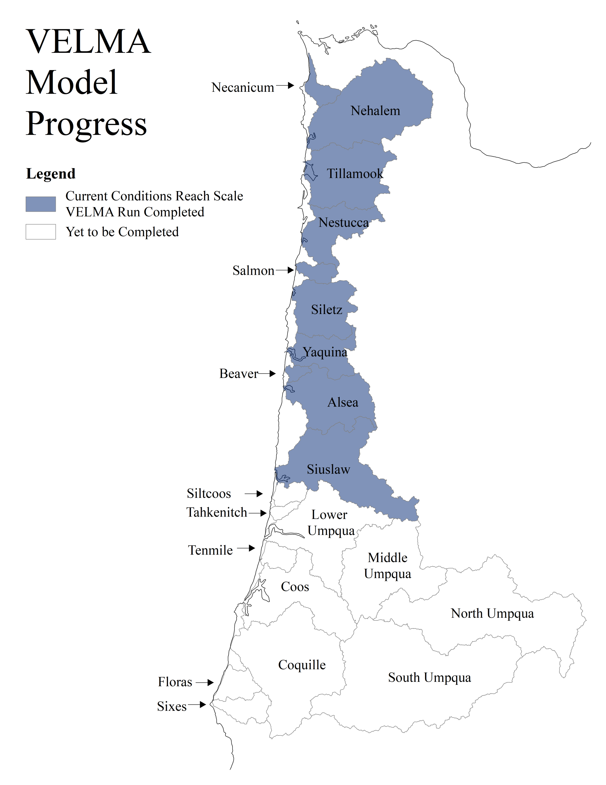
Figure 5. Current conditions VELMA model completion progress
Once current conditions VELMA models are built and are outputting reach scale daily flow, future climate scenarios will be run through VELMA to understand how the timing, quality, and quantity of stream flow may change in the future. This data will be used to understand how flow availability will alter the available habitat for fish species, especially coast Coho. These VELMA models can also be used to understand how forest harvest scenarios will affect instream water availability (https://agupubs.onlinelibrary.wiley.com/doi/full/10.1029/2010WR010165).
For More Information Contact: