Species Vulnerability Modeling
Species distribution models (SDMs) are models that relate species distributional data (e.g. occurrence, abundance) at a particular location with information on the environmental conditions at the same location. SDMs can be used a) to explain relationships between species and habitat, b) for prediction to locations without species data, and/or c) for predictions of distribution under different conditions (e.g. future climate). SDMs will help ODFW better manage native fish species and develop tools to better respond to habitat mitigation needs at the appropriate spatial and temporal scales. From these models, we hope to develop species distribution maps, identify the biggest threats on the landscape, and develop predictive models by evaluating a number of different threat (climate and other disturbance) scenarios. This approach has several appealing features; presence/absence data is relatively easy to collect, once the framework for the model has been developed and evaluated it is adaptive; we can continue to improve the model as we learn more about the species and their distribution. Once we have identified the biggest threats, we can begin to understand the magnitude of the threats and the sensitivity of the species to the threat(s).
There is considerable variability in the observational data that is available for native fish species (most native non-game fish species have very little empirical occupancy (presence/absence) data). REDD plans to work collaboratively with multiple entities to use existing, precise observational data and collect new data where needed.
REDD will be using spatially explicit datasets as attributes describing species distribution. Where temporally explicit species observation data is available, we will obtain seasonal or annual environmental attributes (e.g. stream flow and temperature data). The overarching research goals are to: 1) account for threats that act at a scale consistent with the ability to measure changes in species distribution, 2) simulate a range of environmental change scenarios, including climate, land use/development, disturbance at multiple timescales (e.g., 10, 20, 50, 100 years), and 3) predict habitat/range contraction or expansion and rank species vulnerability. We plan to research the usefulness of newly developed tools and modeling approaches to best model current and future species distributions as a function of environmental data.
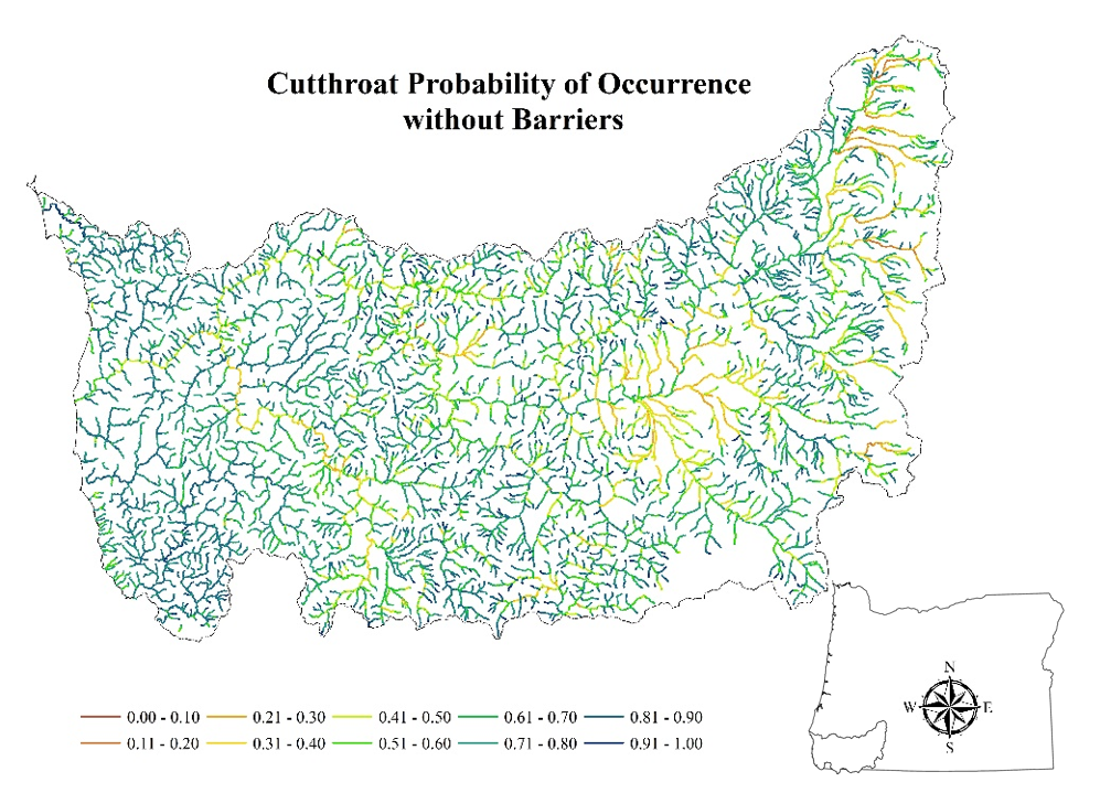
Figure 1. Species distribution model for coastal cutthroat trout in the Rogue-South Coast.
Kara Anlauf-Dunn